Iranian Space Institute Initiates Khayyam Satellite Imagery Commercialization
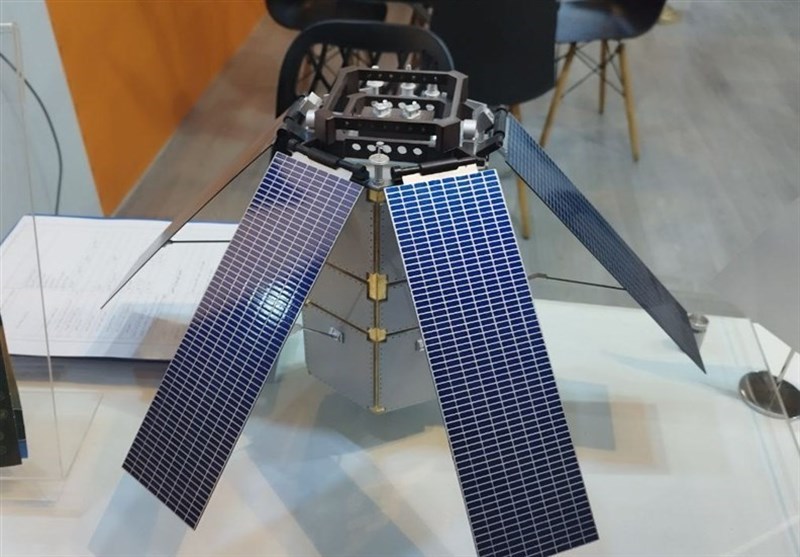
TEHRAN (Tasnim) – Iran's Space Research Institute has commenced the commercialization process of "Khayyam Satellite Imagery," marking a significant stride in expanding its applications across various sectors.
Ahmad Soleimani, the institute's commercialization representative, highlighted Khayyam's potential to competitively pursue market development and emphasized its relevance in sectors such as environmental monitoring and agriculture.
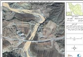
Soleimani expressed the institute's active engagement with governmental and private entities, including collaborations with the Ministry of Agriculture for agricultural land mapping and the Environmental Protection Organization for dam water level monitoring.
He stressed the importance of addressing Iran's environmental needs through satellite imagery, encompassing areas like grassland monitoring, deforestation, and changes in agricultural land. He stressed the significance of addressing diverse organizational needs, including those of entities such as Iran's National Copper Company, a subsidiary of the Ministry of Industry.
Highlighting the global market for satellite imagery traded in square kilometers with dollar prices, Soleimani stressed establishing a competitive market to justify economic feasibility for consumers. The focus extends beyond selling images, intending to create competitive pricing strategies to attract potential buyers.
Emphasizing Khayyam's year-long operation in space and the establishment of comprehensive archives, Soleimani underlined the initiative's readiness to cater to diverse organizational needs across various sectors.